


 Pay online
 Water interruptions
 Road information
 Bin collection
 Tip opening hours
 Pets and animals
 Lodge a DA
 Tree action request
 Libraries
 Venues for hire
 Report an issue
News and Notices
Browse current Council news and notices, or provide us with feedback on current projects via 'Have your say'.
-
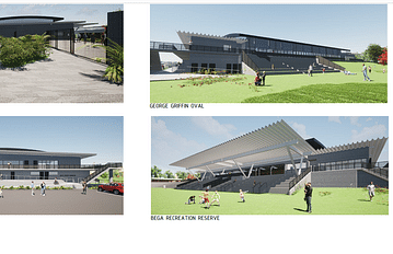
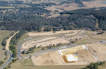
Progress for Bega Sports Complex
The highly awaited upgrade of the Bega Sports Complex is soon set to kick off with the signing and issuing of the of the imminent construction contract which will mark a crucial milestone in the project...
Apr 15, 2024
-
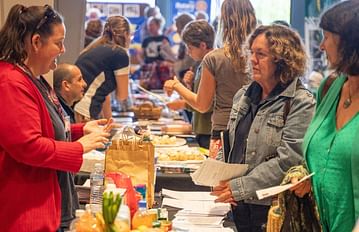
Callout for not-for-profits to join this year’s Volunteer Expo
Bega Valley Shire’s not-for-profit organisations are invited to register for the Many Hands Volunteer Expo at the Oaklands Event Centre on Saturday 25 May between 10am and 2pm.
Apr 9, 2024
-

Surf Skate Sound event to celebrate Youth Week
Bega Valley Shire Council invites young people aged between 12 and 24 years to celebrate NSW Youth Week at the Surf Skate Sound event to be held at the Barclay Street Oval, Eden on Thursday 18 April....
Apr 9, 2024
-
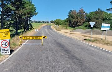
Theft of local contractor signs raises concerns for public safety
Road safety signs belonging to local contractors have been reported stolen from multiple sites throughout the Bega Valley Shire.
Apr 5, 2024
-
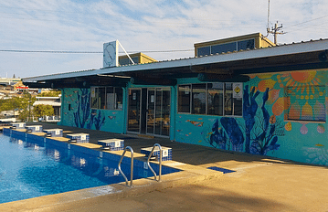
Outdoor swimming pools make a splash as season comes to a close
The Shire’s outdoor swimming pools will close on Thursday 28 March, marking the end of another successful swimming season.
Mar 27, 2024
-
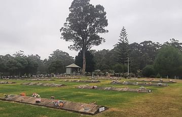
Life in our Cemeteries event at Pambula
Council and Atlas of Life are pleased to present the next Life in our Cemeteries event at the Pambula cemetery on Saturday 13 April from 11am to 3pm.
Mar 25, 2024
-

Draft Policy Data Breach Mandatory Reporting
Have your say on Council's draft Policy Data Beach Mandatory Reporting.
Mar 8, 2024
-

Flood and Sea Level Rise
Have your say on draft Flood and Sea Level Rise Policy and related amendment to Bega Valley Development Control Plan 2013.
Mar 14, 2024
-
Waste Services Review and Customer Satisfaction Survey
Council's Waste Services team is seeking feedback on community satisfaction and service priorities. This survey asks what services are most useful to you, your thoughts on the fairness of our fees...
Mar 13, 2024
-

Development proposals on exhibition
Have your say on applications open for public comment.
Feb 17, 2022
-

Make a Suggestion
Help us make it better, suggest something.
Mar 7, 2022
-
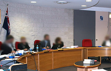
Council Meetings Bega Valley Shire Council
Council meeting information, schedules, agendas and minutes.
Feb 17, 2022
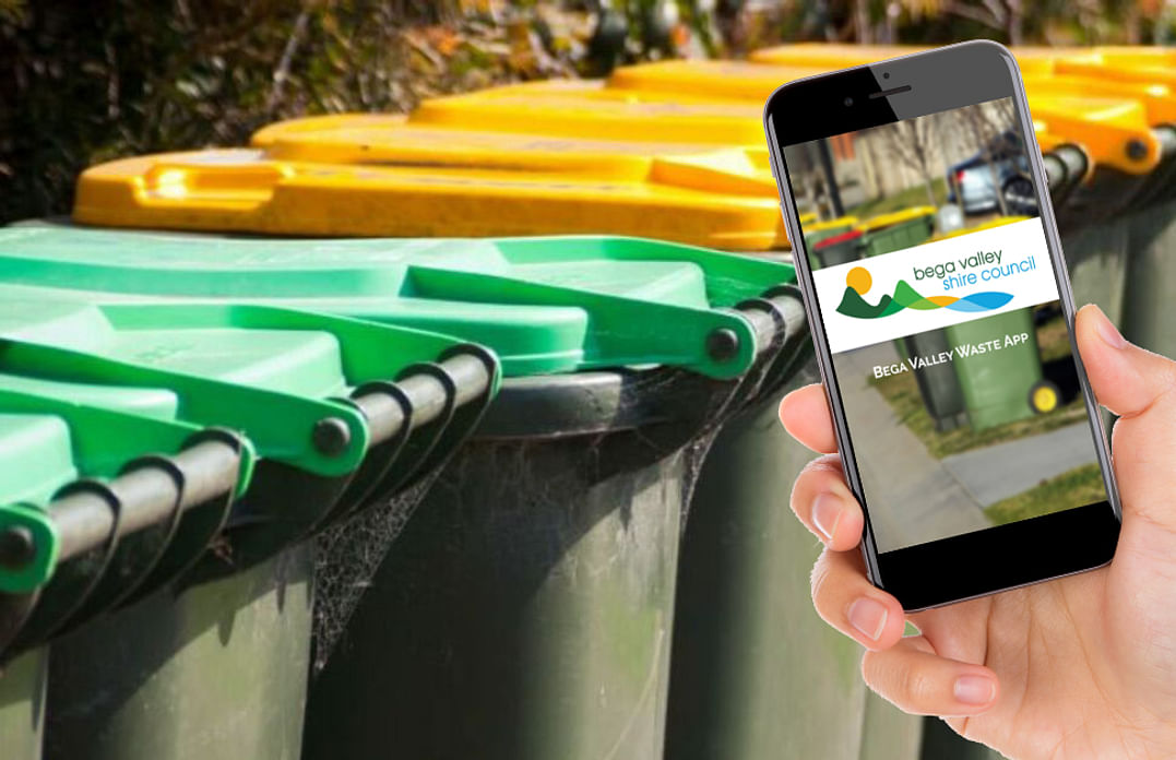
When do I put my bin out?
Council's free Waste App helps you stay up to date with bin collection days and learn how to recycle more effectively.
Don't have the Waste app? Find it by searching for Bega Valley Waste in your App store or head to the website.
Need a venue?
The Bega Valley Commemorative Civic Centre has a range of room hire options to suit your needs.
Find out more
Our Libraries have more than just books!
Check out what the library has on offer.
Bega, Bermagui, Eden and Tura Marrang.

Funding notification
Don't miss out on funding, register your expression of interest and be notified when a grant becomes available.
Register your details© Bega Valley Shire Council 2024
Our council websites
Contact Us
- 02 6499 2222
- council@begavalley.nsw.gov.au
-
Zingel Place
PO Box 492
Bega NSW 2550 -
Monday to Friday 9.00AM to 4.30PM
Administration building Zingel Place Bega
Australia -
ABN: 26 987 935 332