


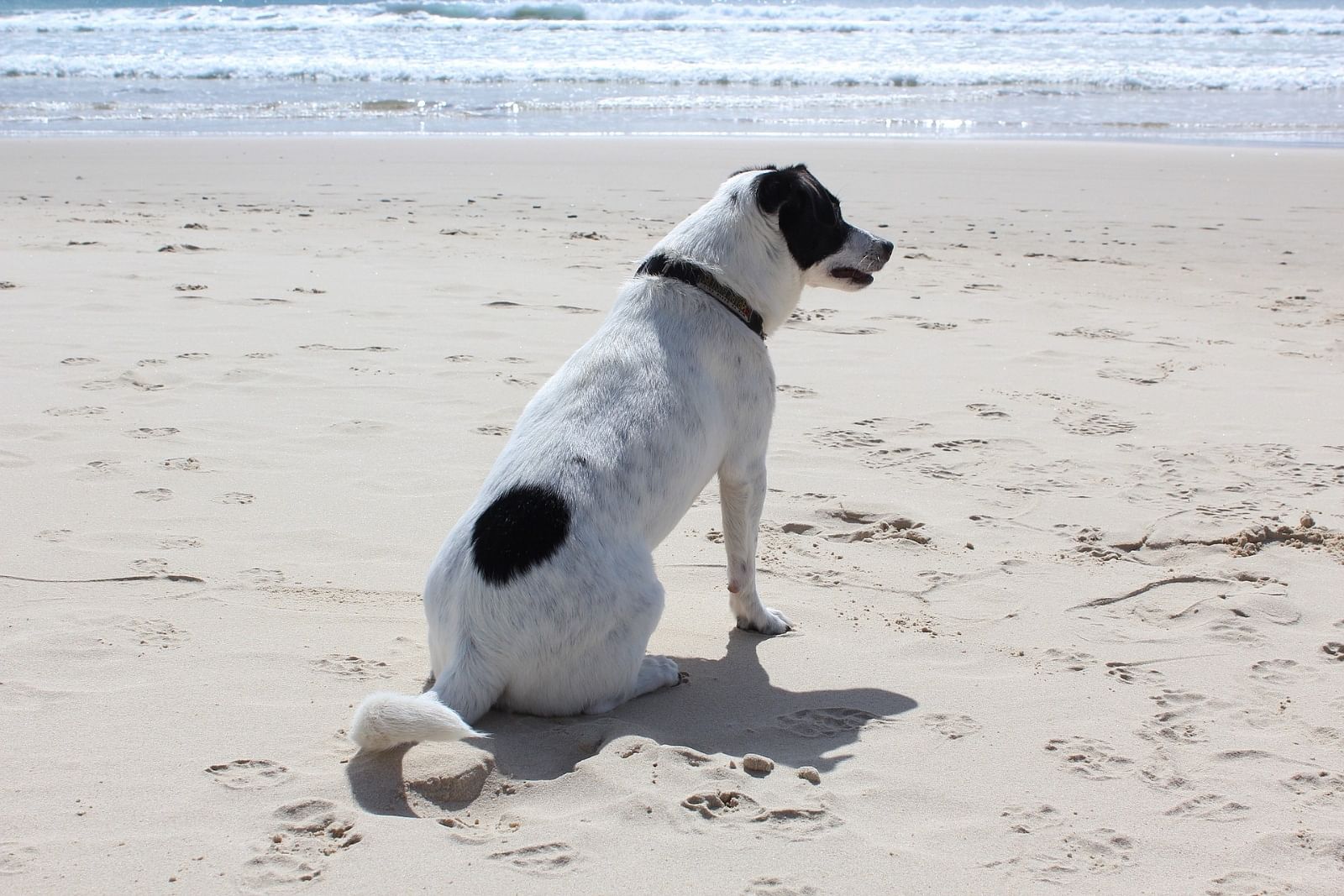
Dog walking areas
Council recognises the important role companion animals play in our society. As such Council provides 15 leash free areas in the Shire where dog owners can responsibly exercise their dogs off leash.
Council recognises the important role companion animals play in our society. There are 15 leash free areas in the Shire where dog owners can responsibly exercise their dogs off leash.
In achieving a balance between dog owners and other members of the community, there are also areas in the Shire where prohibitions are in place. Dog owners should keep their dogs from these prohibited areas.
At all times dog owners and general community members alike should respect each other and help ensure that the enjoyment of companion animals is not to the detriment of our neighbours or the environment.
Please refer to Council's Procedure 4.04.6 Companion Animals Control Areas. To view the procedure visit our Public Policies page and search for Animals Control Areas.
Provision of facilities
Council provides waste disposal bins adjacent to all leash free areas and may also supply dog faeces disposal bags in some locations for the communities’ convenience. When bins or disposal bags are not supplied by Council then dog owners are required to provide and use their own disposal bags and to remove the waste and dispose of it properly.
Council also provides dog faeces disposal bags in dispensers at a number of locations throughout the Shire where dog walkers use walking paths and the like in larger numbers. Waste bins are also provided at most of these locations and dog owners need to be aware of their responsibilities for waste disposal.
When using these popular walking locations dog owners are required to ensure that dogs remain on leash and under effective control, as some dogs will chase other users of walking tracks such as joggers and cyclists.
Leash free
The locations below are linked to aerial maps which show the leash free areas in the Bega Valley Shire. Dogs must be under the control of a competent person. Dog off leash areas do not extend to dunes (beach areas) where there can be negative impacts on dune stabilisation and native flora and fauna.
- Bega
Old Bega Racetrack: (Accessible) – area bounded by the Bega River to the north of Lot 3200 DP 1036584 and by gravel pathway except when used for special events.
- Bermagui
Haywards Beach: beach area south of a line drawn east from the intersection of the Camel Rock access road and Wallaga Lake Road for one (1) kilometre and ending at the junction of the un-named creek and the ocean beach near the Wallaga Lake Road/ Old Tilba Road intersection.
Headland Reserve: reserve area north of Scenic Drive, the eastern boundary formed by the rock cliff and its intersection with a line drawn north east as a continuation of Young Street. The western boundary formed by the eastern edge of the paved road area at the War Memorial in Lamont Street.
Beares Beach: beach area south from the rock headland just south of Paraboon Drive to the rock headland at the southern end of Beares Beach and including the beach area adjacent to Paraboon Drive, Bermagui.
Moorehead Beach: two hundred (200) metres running south east.
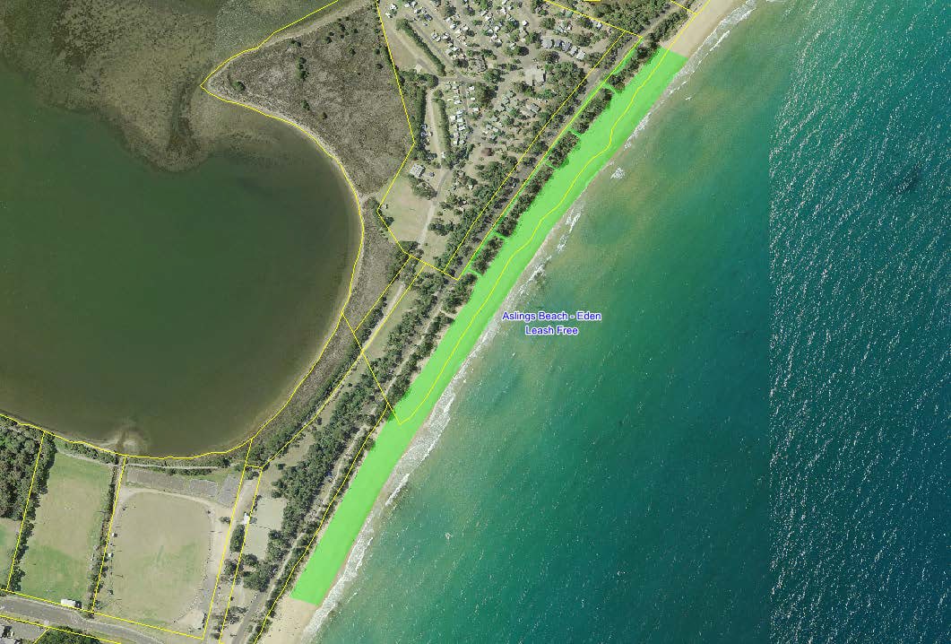
- Eden
Aslings Beach: ocean beach area south from the Curalo Lagoon entrance to a line drawn east from the northern end of the Skate Park at Asling’s Beach Road, and the footpath adjacent to the beach and opposite the caravan park.
Keith’s Pinch Beach: beach area north of the headland at Oman Point and south of the next headland towards Cocora Point in the area known as Keith’s Pinch Beach.
- Merimbula
Short Point Headland: (Accessible) – the reserve area west of the Short Point Beach paved car park, north of the property boundary of the Holiday Park at parcel 21592 and a line drawn east as a continuation of the northern boundary of parcel 21592 and south and west of the cliff edge.
Main Beach: beach area south from a line drawn east as a continuation of Dunns Lane to a point where the access track running east from the Merimbula Airport meets the ocean beach.
Bar Beach: the foreshore area north of the beach below the Bar Beach kiosk, west of foreshore vegetation and south of Spencer Park except for Dec 1-30 Apr between 10am and 4pm when it is a dog prohibited area.
- Pambula Beach
Lions Park: (Jiguma Beach): the beach area north from the Lions Beach carpark pedestrian entry to the rocks and not including any area south of the pedestrian entry, car park or access tracks.
- Tathra
Tathra Beach: the beach area south of a line drawn east from the Tathra Country Club entrance and north of a line drawn east from the northern end of the Holiday Park at parcel 34830.
Punt Landing, Mogareeka: the sand spit area south of Bega River and west of Tathra-Bermagui Road.
- Tura Beach
Tura Beach beach area south of a line drawn east from the northern boundary of property at parcel 8024.(162 Pacific Way) and north of a line drawn east from the boundary of property at parcel 37028.(Surf Circle address) and not including the carparks and beach access tracks.
- Cuttagee
Southern Cuttagee Beach: from the carpark in the south to a line being the extension of northern boundary of Lot 3 DP 558636 and bounded by Tathra Bermagui Road.
Control areas
Council identifies three different categories of dog prohibited areas (DPAs):
Wildlife protection areas (WPAs) - where dogs are prohibited at all times by order of the local authority:
- Bermagui Flora and Fauna Reserve (Long Swamp) – the public area between the road closure at southern end of the reserve from Old Tilba Road to the road closure which includes the dune area, but does not extend to the beach.
- Bermagui Lagoon, between Wallaga Lake Road and Moorhead Beach. The North boundary in direct line East end of Willis Street and South boundary East end of George Street, including timber foot bridges over lagoon.
- Murunna Point, Murunna Point sand spit and part of Wallaga Lake Estuary. In a line from the southern junction of Lot 7015 DP 1052732 and Wallaga Lake Road to the mean high water mark adjacent to the northern point of the northern side of lake mouth, south to Camel Rock and all the Reserve, bounded by private land in the west, Camel Rock access road and car park to the South, and following the southern shore of the lake to the South and North following Wallaga Lake Road back to the Junction of Lot 7015 DP 1052732.
- Barragoot Beach and the northern end of Cuttagee Beach and estuaries excluding the road corridor and car parks on either side of the road, and the area between the road and LF13.
- Mogareeka Inlet sand spits and islands in the estuary East of Tathra Bermagui Road Bridge and the rocks at the Headland south to Lions Park.
- Back Lake and Back Lagoon (near Short Point) Merimbula. Bounded by Whipbird Way, Mirador.
Public bathing areas (PBAs):
A. Where dogs are prohibited at all times by order of the local authority:
- Bar Beach, Merimbula: the foreshore area north of the beach below the Bar Beach kiosk, west of foreshore vegetation and south of Spencer Park from December 1 to 30April between 10am and 4pm
- Bruce Steer Pool, Bermagui, not including the rock groin path.
- The Blue Pools, Bermagui.
B. Where dogs are prohibited seasonally by order of the local authority because these areas are considered public bathing areas during the swimming season:
All lifeguard patrolled beaches within 100m of the patrolled areas indicated by the flags between the dunes and the outer edge of the surf zone. These beaches are:
- Camel Rock, Bermagui
- Horseshoe Bay, Bermagui
- Tathra Beach
- Short Point, Merimbula
- Main Beach, Merimbula
- Pambula Beach
- Asling’s Beach, Eden
Public recreation areas (PRAs) where dogs are prohibited at all times by order of the local authority:
© Bega Valley Shire Council 2024
Our council websites
Contact Us
- 02 6499 2222
- council@begavalley.nsw.gov.au
-
Zingel Place
PO Box 492
Bega NSW 2550 -
Monday to Friday 9.00AM to 4.30PM
Administration building Zingel Place Bega
Australia -
ABN: 26 987 935 332
Was this helpful?